5 Coastal Cities with High Exposure to Sea-Level Rise
An ArcGIS Story Map profiling five major coastal cities facing significant exposure to rising sea levels. Using geospatial analysis and climate projections, the story map examines urban vulnerability, population at risk, and the compounding effects of land subsidence and storm surge across cities in the developing world.
Ho Chi Minh City: Deep-Dive Research
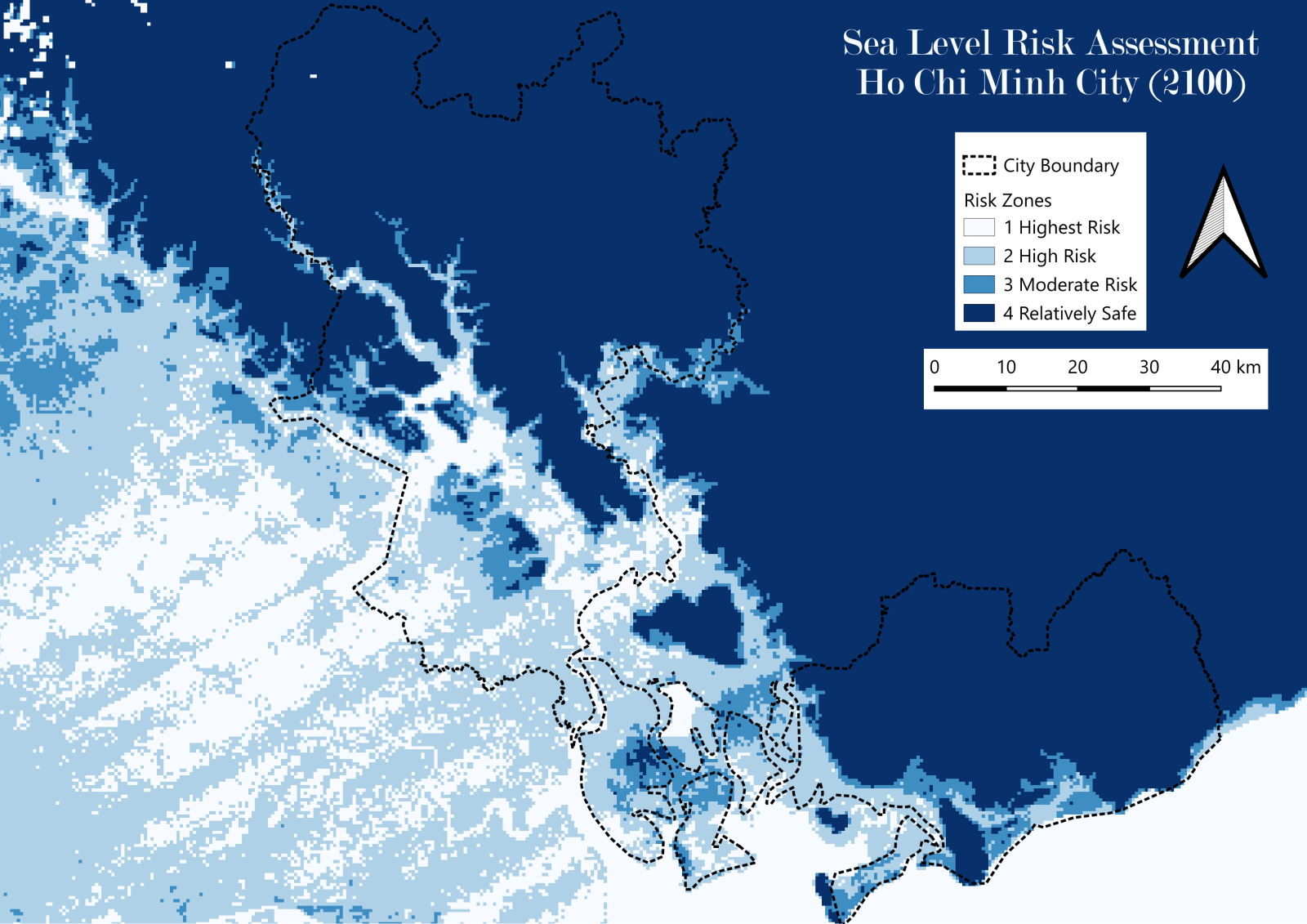
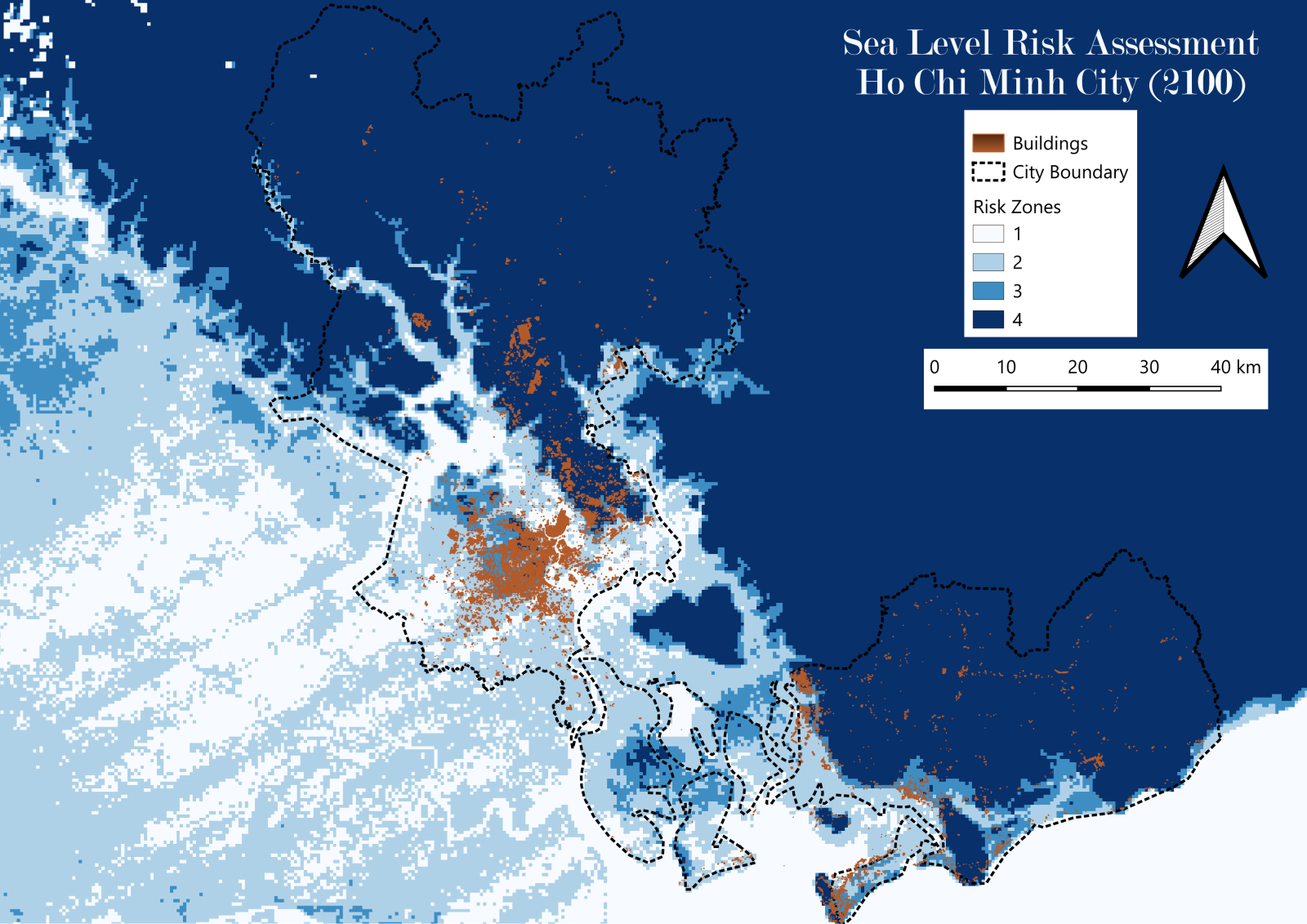
As part of this coastal risk analysis initiative, I conducted detailed geospatial research on Ho Chi Minh City, one of the world's most climate-vulnerable megacities. Using Digital Elevation Model (DEM) data and population projections for 2026 and 2100, the analysis identifies zones at risk of inundation and estimates the population potentially affected under different sea level rise scenarios.
Key Findings
- Low-lying southern and southwestern districts — including Nha Be, Binh Chanh, and Can Gio — face the greatest inundation exposure, with large portions falling below the critical 1-meter elevation threshold under projected sea level rise scenarios.
- The 2100 risk profile is dramatically wider than the 2026 baseline, with inundation zones expanding significantly into densely populated urban districts under high-end projections, underscoring the urgency of near-term adaptive planning rather than deferring mitigation to future decades.
- Population exposure is concentrated in areas that also host critical infrastructure — roads, industrial zones, and residential centers — compounding the economic cost of inaction beyond direct displacement alone.
- The overlay of DEM elevation data with population projections reveals that the communities at highest physical risk are not uniformly the highest-density areas, indicating that risk mapping based on elevation alone understates the true human exposure in certain zones.